The Fascinating History of Gearhart Mountain
Gearhart Mountain, a prominent feature near Bly, Oregon, holds a story millions of years in the making. The mountain rises out of a much older volcanic landscape and preserves evidence of both fire and ice: volcanic construction, long erosion, and later glacial shaping.
Geological work in the Gearhart Mountain Wilderness describes the area as part of a large volcanic edifice built mainly from basaltic to andesitic lava flows during the late Miocene and Pliocene. In practical terms, that means the mountain we recognize today began as a much broader volcanic highland, built by repeated eruptions long before modern Bly existed.
A Volcano in Its Prime
In its active phase, Gearhart Mountain would have looked far different than it does now. Lava flows spread across the region and helped form a broad, unified mass connecting what are now separated ridges, slopes, and uplands. The summit area likely would have been smoother and more continuous, without many of the sharp edges and broken rock faces visible today.
Over time, volcanic activity ceased. What remained was not a single dramatic cone like Mount Hood, but a high volcanic landscape that would spend millions of years being cut down, fractured, and reshaped by weather, water, and ice.
Erosion and Transformation
After volcanism ended, erosion became the dominant force. Wind, runoff, freeze-thaw cycles, and long-term drainage patterns slowly wore away the mountain. Later glaciation added another major layer of transformation. Ice carved into the volcanic rock, helping create steep ridges, exposed cliffs, bowl-like cirques, and the rugged upper terrain associated with the wilderness today.
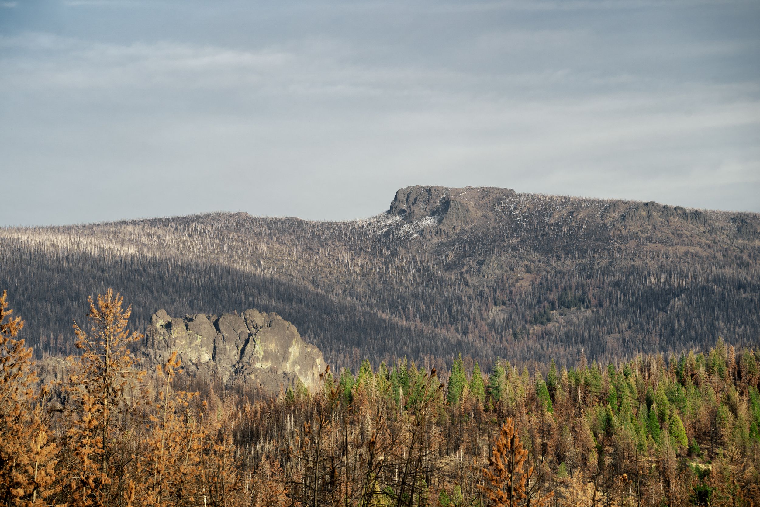
Features such as the Palisade Rocks reflect that long process of exposure and removal. Material that was once part of a broader volcanic system was gradually stripped away, leaving isolated outcrops, sharper relief, and the striking profile that now defines Gearhart Mountain from the Bly area.
Unique Features and Ecology
At 8,364 feet, Gearhart Mountain is the highest point in the Gearhart Mountain Wilderness. Its elevation, geology, and position between ecological zones give it an unusually varied character. Meadows, rocky uplands, volcanic formations, and forested slopes all contribute to the mountain's distinct feel.
Before the Bootleg Fire, the wilderness around Gearhart Mountain included extensive stands of lodgepole pine, ponderosa pine, whitebark pine, and white fir. Lower-elevation forests supported mule deer, elk, black bear, and many bird species. Although much of the old forest structure has changed, the area still offers strong opportunities for wildlife observation and for watching ecological recovery unfold over time.
Exact species counts and ecological boundaries can be difficult to pin down precisely, but the broader pattern is clear: Gearhart Mountain sits at an important transition zone, and that gives the area a richness not always obvious from a distance.
The Influence of Mount Mazama
Another major chapter in the mountain's story came far later, when Mount Mazama erupted about 7,700 years ago. That eruption spread ash and pumice across a huge part of southern Oregon, including the Gearhart area. Those deposits became part of the soil profile and influenced how vegetation established and grew across the region.
In that sense, Gearhart Mountain reflects more than its own volcanic past. It also carries the imprint of one of the most important geologic events in the Pacific Northwest, linking the Bly country to the much larger volcanic history of Crater Lake and Mount Mazama.
Key Events Relevant to Gearhart Mountain
-
Late Miocene to Pliocene, about 11.6 to 2.6 million years ago
Volcanic construction: a large andesitic and basaltic volcanic edifice forms across the high country during the late Cenozoic.
-
Pleistocene, about 2.6 million to 11,700 years ago
Glaciation reshapes the mountain: cirques, U-shaped valleys, and moraines develop, and Blue Lake becomes partly moraine-dammed.
-
Holocene, about 7,700 years ago
Mount Mazama erupts: Mazama tephra spreads across the region and influences soils and vegetation in the Gearhart area.
-
1964
Wilderness protection begins: Gearhart Mountain Wilderness is established under the Wilderness Act.
-
1984
Federal wilderness documentation: the Oregon Wilderness Act is referenced in Forest Service establishment notes connected to the area.
-
2021
Bootleg Fire: the fire severely affects wilderness vegetation and trail conditions.
Gearhart Mountain Drone Videos
View YouTube ChannelSources
- Gearhart Mountain Article Verification and Update Report (PDF)
- U.S. Geological Survey MF-1367 map release page
- U.S. Geological Survey MF-1367 report PDF
- U.S. Geological Survey: Geology and history summary for Mount Mazama and Crater Lake
- U.S. Geological Survey fact sheet FS 092-02 PDF
- USDA Forest Service: Gearhart Mountain Wilderness
- USDA Forest Service: Lookout Rock Trailhead
- USDA Forest Service: North Fork Sprague Trailhead
- U.S. Geological Survey: Sprague River Basin report PDF
- U.S. Geological Survey data release on vegetation conditions during drought and mountain pine beetle activity