A small community with deep roots
Bly is an unincorporated community and census-designated place in southeastern Klamath County, Oregon, USA. It lies along Oregon Route 140 on the high desert plateau, about 50 miles east of Klamath Falls and 37 miles west of Lakeview.
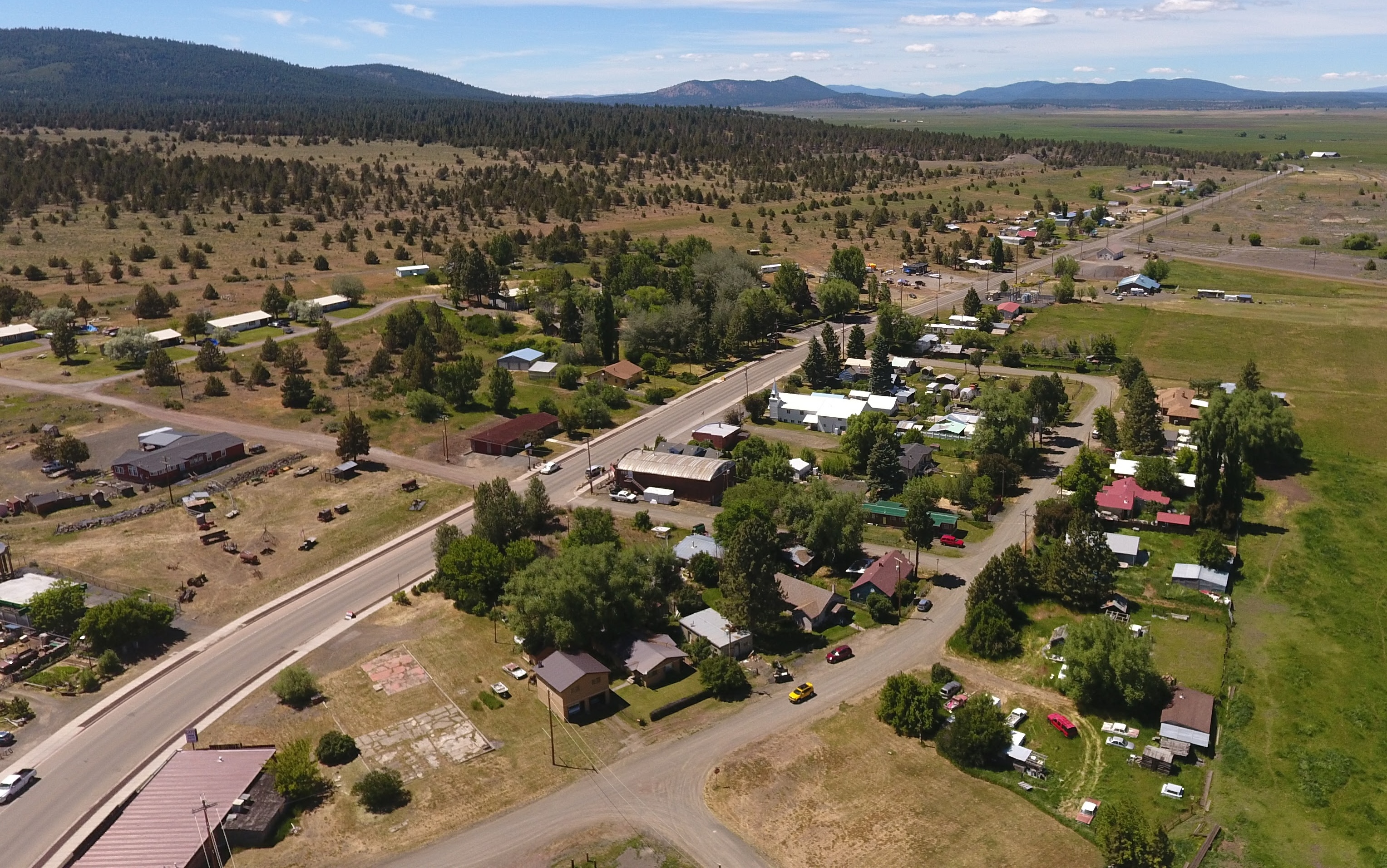
With a small population of just over 200 people, Bly is a quiet rural hub surrounded by forests, ranchlands, and natural features that reflect its deep connection with the high desert environment.
At a glance
- Founded: Originally Sprague River post office established in 1873; renamed Bly in 1883
- Elevation: ~4,367 feet
- Location: Klamath County, Oregon
- Major Road: Oregon Route 140
- Population: 207 (2020 Census)
- ZIP Code: 97622
- Area Codes: 458 & 541
Landscape and climate
Bly is located just west of the Lake County line in the high prairie lands of southeastern Oregon. Fish Hole Creek flows through the community before feeding into the South Fork Sprague River. The Fremont-Winema National Forest nearly encircles Bly, providing a stunning backdrop of pine, juniper, and rugged hills. To the northeast lies the Gearhart Mountain Wilderness, a protected area of forested slopes, lakes, and volcanic landscapes.
The climate is typical of high desert regions: warm, dry summers with cool nights and cold winters with occasional snowfall. Summers generally remain comfortable, with average temperatures that rarely climb into extreme heat, reflecting a Mediterranean-influenced high desert pattern.
The short version
Bly grew along the upper Sprague River corridor and became a service point for nearby ranching, forest work, and travel routes. For a deeper timeline, visit the History page for key dates, stories, and archival materials.
Outdoor access
The OC&E Woods Line State Trail — Oregon’s longest linear state park — passes through Bly, tracing the old railbeds of the Oregon, California and Eastern Railroad. The trail spans roughly 100 miles of mixed-surface paths suitable for hiking, biking, and horseback riding.
In addition to the state trail, the nearby Fremont-Winema National Forest and Gearhart Mountain Wilderness offer abundant opportunities for hiking, camping, hunting, fishing, and wildlife viewing. Sycan Marsh, a short drive north, is a prime birdwatching and nature study area, especially during seasonal migrations.